Area Survey App
Online app that can be used to make an exact plot of a surveyed area - like a room, a property or any 2D shape.
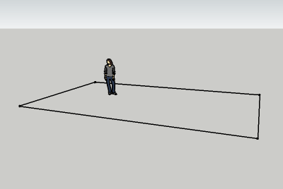
Use this application to make an exact plot - as indicated below - of a room, a property or any two dimensional area. The plot can be printed or saved with the calculated lengths, diagonales and angles. The plot can also be exported as an area to the amazing free 3D modeling software Sketchup.
This application can be very useful if you want to make an exact plot of an "irregular" area with many corners and distorted angles.
How to Use
- Make the reference line A - B. It can be a virtual line between two points in the same level - or a physical line like the edge of a carpet, the edge of table or kitchen worktop. All points for measure must be visible and possible to measure from both A and B. It is important that the reference line and all measure lines are in the same level (or plane) to avoid plot distortion.
- Measure the distance A - B. The calculator is generic so you can use any unit - as long as you use the same unit for all data.
- Mark the measure points clockwise from 1 to max 9.
- Measure distances from control points to measure points. Indicate the position of the measured point to the reference line A-B - mark if point is below the reference line.
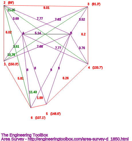
- Calculate! - Side lengths, diagonals and angles are calculated and the figure below redraws. Values for export to Sketchup and the Engineering ToolBox extension - "Lines made from Custom Points" are calculated too - see below.
The Survey Plot
The survey plot below is redrawn when values below are changed and "Calculate!" button is clicked.
- control line A - B is in black
- measured lines are in purple
- calculated sides and angles are in red
- calculated diagonals are in green
Distance between Control Points
| Distance between Control Points (m, mm, ft, in ...) |
|
| A - B | |
Distance between Control Points and Measured Points
| Distance between Control Points and Measure Points (m, mm, ft, in ...) |
|||
| A | B | Below A - B | |
| 1 | |||
| 2 | |||
| 3 | |||
| 4 | |||
| 5 | |||
| 6 | |||
| 7 | |||
| 8 | |||
| 9 | |||
Calculated Angles
Calculated Sides
Calculated Diagonals
Export the Plot to Sketchup - the amazing free 3D modelling software

Copy the red, green and blue coordinates from the textbox below and paste them into the input box in the free Engineering ToolBox extension - "Lines made from Custom Points".
Note! the Engineering ToolBox plugin window must be opened from within Sketchup before pasting the data.
|
x, y, z
|
The values above are plain Cartesian x,y (and z) coordinates that can be transferred manually to almost any type of CAD system.
Tip! In Sketchup - add a "face" to the plot area and use the push/pull tool to make a 3D model of the room or object you are surveying.
SVG File
The svg file format can be used with most drawing, cad and web based applications.
Copy the SVG code from the window that opens below and paste it to your drawing or document. Note - due to the svg format all coordinates are made positive. Coordinates are offset with the smallest x and y values.


